
1969 Map of Cool Springs
USGS Topo · Published 1972About this map
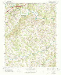
The South Yadkin River serves as the dominant natural boundary on this 1969 survey, tracing the winding border between Davie and Rowan counties. This Piedmont landscape is characterized by a dense network of tributaries including Fourth Creek and Third Creek, which historically supported the agricultural development of small crossroads communities like Cool Springs and Mount Vernon. The map reveal a deeply rooted social geography, evidenced by the high concentration of rural sanctuaries such as Moores Chapel, New Jerusalem Ch, and South River Ch. These landmarks, along with local settlements like Needmore and Davie Academy Corners, provide a detailed record of the rural habitation patterns and property boundaries that defined this region of North Carolina in the late 1960s.
Find a feature on this map
22 named features on this map. Tap any name to fly to it.
Don’t see what you’re looking for? This feature index may not catch every label — zoom into the map to look around manually.
Map Details
Editions of this 1969 Cool Springs Map
2 editions found
Other maps of this area

1893 · Statesville
USGS Topo · 1:125,000

1953 · Charlotte
USGS Topo · 1:250,000

1954 · Charlotte
USGS Topo · 1:250,000

1960 · Charlotte
USGS Topo · 1:250,000

1962 · Charlotte
USGS Topo · 1:250,000

1969 · Cooleemee
USGS Topo · 1:24,000

1969 · Shepherds
USGS Topo · 1:24,000
1969 · Harmony
USGS Topo · 1:24,000
1969 · Mocksville
USGS Topo · 1:24,000
1969 · Calahaln
USGS Topo · 1:24,000