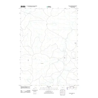
2012 Map of Cooley Draw
USGS Topo · Published 2012About this map
Little Lightning Cr meanders through this section of eastern Wyoming, carving a path through a landscape defined by prominent rises and drainage basins. The area is characterized by the Hamilton Hills to the east and Flat Top Hill in the west, with the eponymous Cooley Draw providing a central landmark for navigating this high plains terrain. Significant water sources for local ranching and wildlife are noted at Three Willow Spring and along Spring Br Harney Cr.
Find a feature on this map
9 named features on this map. Tap any name to fly to it.
Don’t see what you’re looking for? This feature index may not catch every label — zoom into the map to look around manually.
Map Details
Editions of this 2012 Cooley Draw Map
This is the sole edition of this map. No revisions or reprints were ever made.
Other maps of this area

1954 · Torrington
USGS Topo · 1:250,000

1955 · Newcastle
USGS Topo · 1:250,000

1958 · Torrington
USGS Topo · 1:250,000

1958 · Newcastle
USGS Topo · 1:250,000

1970 · Lost Springs
USGS Topo · 1:24,000

1970 · Lost Springs NW
USGS Topo · 1:24,000

1970 · Cooley Draw
USGS Topo · 1:24,000

1970 · Keeline
USGS Topo · 1:24,000

1981 · Bills Creek
USGS Topo · 1:24,000
1981 · Split Hill SW
USGS Topo · 1:24,000