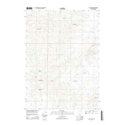
2015 Map of Cooley Draw
USGS Topo · Published 2015About this map
Three Willow Spring and the drainage of Little Lightning Cr define this high-plains landscape in Niobrara County, where the topography of the Powder River Basin is punctuated by prominent relief. The map reveals a network of erosional features and upland ridges, including the Cedar Breaks and the Hamilton Hills to the east. Modern access is traced via Twenty Mile Rd and Divide Rd, which follow the high ground between deeply incised watercourses. The local geology is expressed through distinctive landmarks such as Dumbell Rock Draw and the Horseshoe Hills, illustrating the complex drainage patterns of Spring Br Harney Cr in this corner of Wyoming. This 2015 survey provides a clear view of the section lines and township boundaries that organize this ranching and energy-producing country.
Find a feature on this map
19 named features on this map. Tap any name to fly to it.
Don’t see what you’re looking for? This feature index may not catch every label — zoom into the map to look around manually.
Map Details
Editions of this 2015 Cooley Draw Map
This is the sole edition of this map. No revisions or reprints were ever made.
Other maps of this area

1954 · Torrington
USGS Topo · 1:250,000

1955 · Newcastle
USGS Topo · 1:250,000

1958 · Torrington
USGS Topo · 1:250,000

1958 · Newcastle
USGS Topo · 1:250,000

1970 · Lost Springs
USGS Topo · 1:24,000

1970 · Lost Springs NW
USGS Topo · 1:24,000

1970 · Cooley Draw
USGS Topo · 1:24,000

1970 · Keeline
USGS Topo · 1:24,000

1981 · Bills Creek
USGS Topo · 1:24,000
1981 · Split Hill SW
USGS Topo · 1:24,000