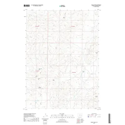
2017 Map of Cooley Draw
USGS Topo · Published 2017About this map
Cedar Canyon and the high plateaus of Niobrara County define the northern reaches of this High Plains landscape. The area is characterized by an intricate network of drainage systems, most notably Cooley Draw, Flat-Top Draw, and the curiously named Dumbell Rock Draw. These ephemeral watercourses carve through the terrain between prominent landmarks like Flat Top Hill and the Hamilton Hills in the east.
Find a feature on this map
18 named features on this map. Tap any name to fly to it.
Don’t see what you’re looking for? This feature index may not catch every label — zoom into the map to look around manually.
Map Details
Editions of this 2017 Cooley Draw Map
This is the sole edition of this map. No revisions or reprints were ever made.
Other maps of this area

1954 · Torrington
USGS Topo · 1:250,000

1955 · Newcastle
USGS Topo · 1:250,000

1958 · Torrington
USGS Topo · 1:250,000

1958 · Newcastle
USGS Topo · 1:250,000

1970 · Lost Springs
USGS Topo · 1:24,000

1970 · Lost Springs NW
USGS Topo · 1:24,000

1970 · Cooley Draw
USGS Topo · 1:24,000

1970 · Keeline
USGS Topo · 1:24,000

1981 · Bills Creek
USGS Topo · 1:24,000
1981 · Split Hill SW
USGS Topo · 1:24,000