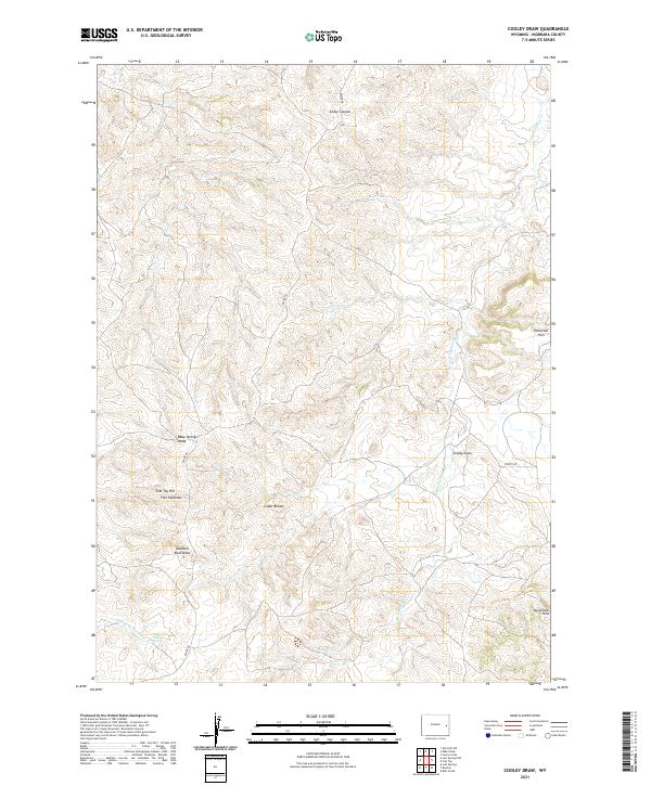
2021 Map of Cooley Draw
USGS Topo · Published 2021About this map
Cedar Breaks and the Hamilton Hills define the high plains topography of this Niobrara County region. This 2021 survey documents a landscape dominated by complex drainage systems and ridges, where Divide Rd serves as a primary corridor through the northern and western sections. The terrain is marked by named geographic landmarks like Flat Top Hill and Dumbell Rock Draw, reflecting the naming conventions of the Wyoming ranching tradition.
Find a feature on this map
18 named features on this map. Tap any name to fly to it.
Don’t see what you’re looking for? This feature index may not catch every label — zoom into the map to look around manually.
Map Details
Editions of this 2021 Cooley Draw Map
This is the sole edition of this map. No revisions or reprints were ever made.
Other maps of this area

1954 · Torrington
USGS Topo · 1:250,000

1955 · Newcastle
USGS Topo · 1:250,000

1958 · Torrington
USGS Topo · 1:250,000

1958 · Newcastle
USGS Topo · 1:250,000

1970 · Lost Springs
USGS Topo · 1:24,000

1970 · Lost Springs NW
USGS Topo · 1:24,000

1970 · Cooley Draw
USGS Topo · 1:24,000

1970 · Keeline
USGS Topo · 1:24,000

1981 · Bills Creek
USGS Topo · 1:24,000
1981 · Split Hill SW
USGS Topo · 1:24,000