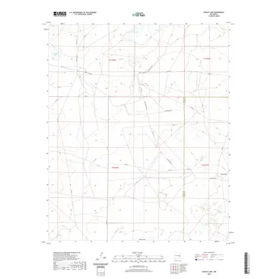
2020 Map of Cooley Lake
USGS Topo · Published 2020About this map
Cooley Lake and Urton Lake anchor this High Plains landscape along the boundary of De Baca and Chaves Counties. The terrain is defined by wide drainage patterns like White Draw and a network of rural routes that speak to the area's ranching and educational history, most notably Liberty School Rd. While large settlements are absent, the map detail focuses on the essential water sources and transit corridors of the region, including North Tank and specialized paths such as Table Mountain Rd.
Find a feature on this map
28 named features on this map. Tap any name to fly to it.
Don’t see what you’re looking for? This feature index may not catch every label — zoom into the map to look around manually.
Map Details
Editions of this 2020 Cooley Lake Map
This is the sole edition of this map. No revisions or reprints were ever made.
Other maps of this area

1954 · Fort Sumner
USGS Topo · 1:250,000

1955 · Roswell
USGS Topo · 1:250,000

1958 · Fort Sumner
USGS Topo · 1:250,000

1958 · Roswell
USGS Topo · 1:250,000

1962 · Roswell
USGS Topo · 1:250,000

1967 · Deering Place
USGS Topo · 1:24,000

1967 · Eighteenmile Hill
USGS Topo · 1:24,000

1967 · Hernandez Lake
USGS Topo · 1:24,000
1967 · La Espia Peak
USGS Topo · 1:24,000
1967 · Conejo Creek East
USGS Topo · 1:24,000