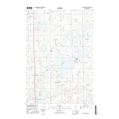
2016 Map of Coon Lake Beach
USGS Topo · Published 2016About this map
The sprawling waters of Coon Lake and its residential community at Coon Lake Beach dominate this landscape in Anoka County. The area is characterized by a high density of wetlands and smaller water bodies such as Neds Lake, Deer Lake, and the expansive Anderson Lake. Local history and genealogy are well-represented by several community landmarks, including Our Saviour's Lutheran Church-Cem and the Oak Hill Cem. The southern portion of the map reveals the small settlements of Soderville and Lake Netta, while the north features the rural crossroads of Mort. This 2016 survey also documents the aviation history at Harry-Walt Airport and the complex drainage network indicated by County Ditch Number Fifty-eight, reflecting the long-term management of this glacial terrain for local development and agriculture.
Find a feature on this map
144 named features on this map. Tap any name to fly to it.
Don’t see what you’re looking for? This feature index may not catch every label — zoom into the map to look around manually.
Map Details
Editions of this 2016 Coon Lake Beach Map
This is the sole edition of this map. No revisions or reprints were ever made.
Other maps of this area

1902 · White Bear
USGS Topo · 1:62,500

1902 · Anoka
USGS Topo · 1:62,500

1916 · St. Francis
USGS Topo · 1:62,500

1919 · St. Francis
USGS Topo · 1:62,500

1952 · Centerville
USGS Topo · 1:24,000

1953 · Stillwater
USGS Topo · 1:250,000

1955 · Circle Pines
USGS Topo · 1:24,000

1955 · Coon Rapids
USGS Topo · 1:24,000

1955 · Isanti
USGS Topo · 1:62,500

1955 · Anoka
USGS Topo · 1:62,500