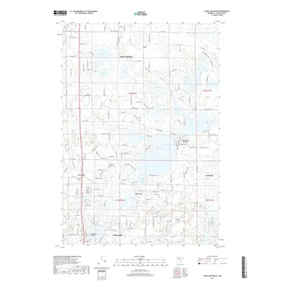
2019 Map of Coon Lake Beach
USGS Topo · Published 2019About this map
Coon Lake Beach and the surrounding Anoka County landscape are defined by a complex network of glacial lakes and managed waterways. Central to the area, Coon Lake and South Coon Lake are surrounded by residential clusters and the small settlement of Mort to the north. The presence of County Ditch Number Fifty-eight and County Ditch Number Fifty-four illustrates the significant drainage engineering required to manage this low-lying, lake-rich terrain. For those tracing family histories, several burial grounds are scattered throughout the quadrangle, including the Our Saviour's Lutheran Church Cem and Soderville Cem. Further south, the map details the community of Ham Lake and the eponymous Ham Lake itself, featuring the uniquely named Temperance Island. The transition from the more developed shores of Coon Lake Beach to the wetlands and smaller basins like Devil Lake and Rice Lake provides a clear view of modern land use in this part of Minnesota.
Find a feature on this map
146 named features on this map. Tap any name to fly to it.
Don’t see what you’re looking for? This feature index may not catch every label — zoom into the map to look around manually.
Map Details
Editions of this 2019 Coon Lake Beach Map
This is the sole edition of this map. No revisions or reprints were ever made.
Other maps of this area

1902 · White Bear
USGS Topo · 1:62,500

1902 · Anoka
USGS Topo · 1:62,500

1916 · St. Francis
USGS Topo · 1:62,500

1919 · St. Francis
USGS Topo · 1:62,500

1952 · Centerville
USGS Topo · 1:24,000

1953 · Stillwater
USGS Topo · 1:250,000

1955 · Circle Pines
USGS Topo · 1:24,000

1955 · Coon Rapids
USGS Topo · 1:24,000

1955 · Isanti
USGS Topo · 1:62,500

1955 · Anoka
USGS Topo · 1:62,500