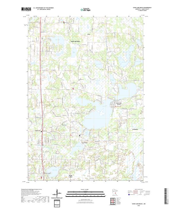
2022 Map of Coon Lake Beach
USGS Topo · Published 2022About this map
The low-lying wetlands and glacial lake basins of Anoka County define this landscape, where residential clusters like Coon Lake Beach meet vast marshy expanses. Centered on the sprawling Coon Lake, the map reveals a pattern of modern development interwoven with rural heritage, including numerous historic burial grounds such as Our Saviours Lutheran Cem and Oak Hill Cem. The area is characterized by an intricate water system, featuring South Coon Lake, Neds Lake, and the winding Coon Cr, alongside man-made drainage efforts like County Ditch Number Fiftyeight. To the west, Soderville serves as a local hub near Temperance Island, while the northern portion of the quadrangle is anchored by East Bethel and the small settlement of Mort. This map provides a detailed view of the transition between suburban expansion and the preserved natural hydrology of the Twin Cities' northern reaches.
Find a feature on this map
80 named features on this map. Tap any name to fly to it.
Don’t see what you’re looking for? This feature index may not catch every label — zoom into the map to look around manually.
Map Details
Editions of this 2022 Coon Lake Beach Map
This is the sole edition of this map. No revisions or reprints were ever made.
Other maps of this area

1902 · White Bear
USGS Topo · 1:62,500

1902 · Anoka
USGS Topo · 1:62,500

1916 · St. Francis
USGS Topo · 1:62,500

1919 · St. Francis
USGS Topo · 1:62,500

1952 · Centerville
USGS Topo · 1:24,000

1953 · Stillwater
USGS Topo · 1:250,000

1955 · Circle Pines
USGS Topo · 1:24,000

1955 · Coon Rapids
USGS Topo · 1:24,000

1955 · Isanti
USGS Topo · 1:62,500

1955 · Anoka
USGS Topo · 1:62,500