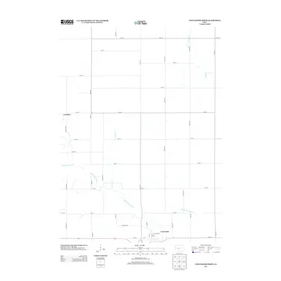
2013 Map of Coon Rapids North
USGS Topo · Published 2013About this map
Coon Rapids serves as the focal point of this rural Iowa landscape, situated along the southern edge where residential streets like Cardinal Dr and Hickory Ln meet the meandering Middle Raccoon River. The terrain is defined by a rigid grid of agricultural roads, including Union Ave and Timber Ave, which partition the fertile land into systematic blocks typical of Carroll County farming. Water management is a primary feature of this environment, seen in the natural winding paths of Calamus Cr and Willow Cr, contrasted by the engineered straightness of Drainage Ditch Number 9-13. In the northwest, the Carrollton boundary indicates the location of a significant historical settlement area. The presence of Stagecoach Rd provides a direct connection to earlier transit corridors that predated the modern highway system, illustrating the evolution of travel in the region.
Find a feature on this map
34 named features on this map. Tap any name to fly to it.
Don’t see what you’re looking for? This feature index may not catch every label — zoom into the map to look around manually.
Map Details
Editions of this 2013 Coon Rapids North Map
This is the sole edition of this map. No revisions or reprints were ever made.
Other maps of this area

1954 · Omaha
USGS Topo · 1:250,000

1954 · Fort Dodge
USGS Topo · 1:250,000

1957 · Omaha
USGS Topo · 1:250,000

1957 · Fort Dodge
USGS Topo · 1:250,000

1958 · Omaha
USGS Topo · 1:250,000

1958 · Fort Dodge
USGS Topo · 1:250,000

1971 · Coon Rapids South
USGS Topo · 1:24,000

1971 · Viola Center
USGS Topo · 1:24,000

1971 · Dedham
USGS Topo · 1:24,000

1971 · Coon Rapids NE
USGS Topo · 1:24,000