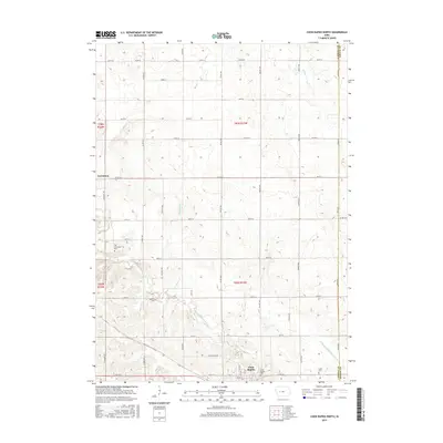
2015 Map of Coon Rapids North
USGS Topo · Published 2015About this map
Coon Rapids sits at the southern edge of this West Central Iowa landscape, where the Middle Raccoon River carves a winding path through the prairie terrain. To the north lies Carrollton, a small settlement marking the historical core of the township. The map reveals a highly structured grid of section roads, but the natural drainage patterns of Willow Cr and Calamus Cr interrupt this geometry, showing the persistent influence of the river valley on local development. Genealogists will find several burial sites documented, including Old Carrollton Cem, Oak Hill Cem, and Union Cem. A notable piece of local transit history is preserved in the naming of Stagecoach Rd, which hints at earlier travel corridors through the county. The transition from natural waterways to agricultural management is visible in the presence of Drainage Ditch Number 9-13 near the Greene County line.
Find a feature on this map
32 named features on this map. Tap any name to fly to it.
Don’t see what you’re looking for? This feature index may not catch every label — zoom into the map to look around manually.
Map Details
Editions of this 2015 Coon Rapids North Map
This is the sole edition of this map. No revisions or reprints were ever made.
Other maps of this area

1954 · Omaha
USGS Topo · 1:250,000

1954 · Fort Dodge
USGS Topo · 1:250,000

1957 · Omaha
USGS Topo · 1:250,000

1957 · Fort Dodge
USGS Topo · 1:250,000

1958 · Omaha
USGS Topo · 1:250,000

1958 · Fort Dodge
USGS Topo · 1:250,000

1971 · Coon Rapids South
USGS Topo · 1:24,000

1971 · Viola Center
USGS Topo · 1:24,000

1971 · Dedham
USGS Topo · 1:24,000

1971 · Coon Rapids NE
USGS Topo · 1:24,000