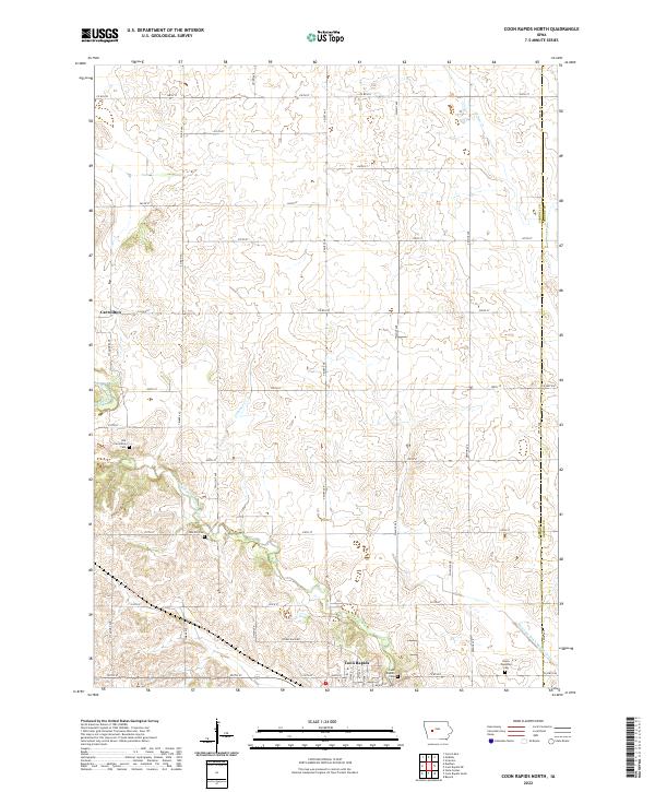
2022 Map of Coon Rapids North
USGS Topo · Published 2022About this map
The Middle Raccoon River cuts through the southwest corner of this western Iowa landscape, where the northern outskirts of Coon Rapids meet the rural township of Carrollton. The topography is defined by the drainage basins of Calamus Cr and Willow Cr, flowing toward the river through a grid of section lines and gravel roads. This modern survey preserves the locations of several burial grounds essential for genealogical research, including the Old Carrollton Cem and Oak Hill Cem near the river, as well as the Coon Rapids Cem and Union Township Cem further east. Along the Carroll and Greene County line, the agricultural infrastructure is evident in the straight course of Drainage Ditch Number 9-13, illustrating the decades-long transformation of the prairie into productive farmland. Traceable remnants of regional travel persist in labels like Stagecoach Rd, indicating the historical transit corridors that preceded the modern county highway system.
Find a feature on this map
49 named features on this map. Tap any name to fly to it.
Don’t see what you’re looking for? This feature index may not catch every label — zoom into the map to look around manually.
Map Details
Editions of this 2022 Coon Rapids North Map
This is the sole edition of this map. No revisions or reprints were ever made.
Other maps of this area

1954 · Omaha
USGS Topo · 1:250,000

1954 · Fort Dodge
USGS Topo · 1:250,000

1957 · Omaha
USGS Topo · 1:250,000

1957 · Fort Dodge
USGS Topo · 1:250,000

1958 · Omaha
USGS Topo · 1:250,000

1958 · Fort Dodge
USGS Topo · 1:250,000

1971 · Coon Rapids South
USGS Topo · 1:24,000

1971 · Viola Center
USGS Topo · 1:24,000

1971 · Dedham
USGS Topo · 1:24,000

1971 · Coon Rapids NE
USGS Topo · 1:24,000