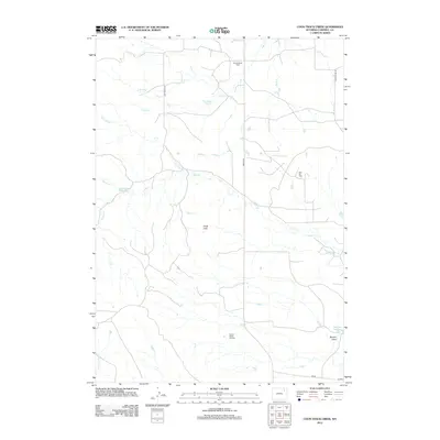
2012 Map of Coon Track Creek
USGS Topo · Published 2012About this map
The energy economy of the Powder River Basin is clearly visible on this landscape, defined by several active extraction sites. Key industrial markers include the Halverson Oil Field in the north and the Pickrel Ranch Oil Field to the south, connected by a network of rural routes like Bishop Rd and Jack Smith Rd. This area of Campbell County is a dry, dissected upland where water management is critical, as seen in the placement of Raccoon Reservoir and Williams Reservoir among the draws.
Find a feature on this map
18 named features on this map. Tap any name to fly to it.
Don’t see what you’re looking for? This feature index may not catch every label — zoom into the map to look around manually.
Map Details
Editions of this 2012 Coon Track Creek Map
This is the sole edition of this map. No revisions or reprints were ever made.
Other maps of this area

1954 · Gillette
USGS Topo · 1:250,000

1955 · Gillette
USGS Topo · 1:250,000

1958 · Gillette
USGS Topo · 1:250,000

1962 · Gillette
USGS Topo · 1:250,000

1971 · Coyote Draw
USGS Topo · 1:24,000

1971 · Coon Track Creek
USGS Topo · 1:24,000

1971 · Whitetail Creek
USGS Topo · 1:24,000
1971 · Whitetail Creek SE
USGS Topo · 1:24,000

1971 · Rozet
USGS Topo · 1:24,000
1971 · Rozet SE
USGS Topo · 1:24,000