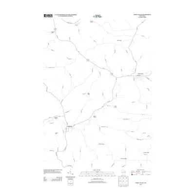
2013 Map of Coon Valley
USGS Topo · Published 2013About this map
Coon Valley and Chaseburg anchor this topographical study of Vernon County, defined by a complex network of ridges and narrow valleys known locally as coulees. The path of Coon Cr dictates the local geography, winding through the center of the map past landmarks like Hohlfeld Coulee and Koll Coulee. The upland terrain is characterized by prominent high points such as Brinkman Ridge, Gronvold Ridge, and Pumpkin Ridge, which separate the various drainage basins. The road network, including Us-14 61 and County Hwy-K, follows these natural contours, illustrating how the driftless area's unique geology has shaped modern transportation and settlement patterns. Further south, Enterprise Ridge and Bunker Hill provide significant elevation changes, while Dodson Hollow serves as a notable lowland feature amidst the surrounding heights.
Find a feature on this map
70 named features on this map. Tap any name to fly to it.
Don’t see what you’re looking for? This feature index may not catch every label — zoom into the map to look around manually.
Map Details
Editions of this 2013 Coon Valley Map
This is the sole edition of this map. No revisions or reprints were ever made.
Other maps of this area

1909 · Sparta
USGS Topo · 1:62,500

1923 · Viroqua
USGS Topo · 1:62,500

1926 · Stoddard
USGS Topo · 1:62,500

1926 · Viroqua
USGS Topo · 1:62,500

1927 · La Crosse
USGS Topo · 1:62,500

1930 · La Crosse
USGS Topo · 1:62,500

1947 · Sparta
USGS Topo · 1:62,500

1949 · Sparta
USGS Topo · 1:62,500

1958 · La Crosse
USGS Topo · 1:250,000

1961 · La Crosse
USGS Topo · 1:250,000