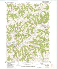
1983 Map of Coon Valley
USGS Topo · Published 1983About this map
Coon Valley and Chaseburg anchor this topographical survey of a deeply dissected landscape where the La Crosse and Vernon County line bisects high ridges and narrow coulees. The terrain is defined by dramatic elevation changes between the Coon Creek valley floor and prominent heights like Brinkman Ridge and Gronvold Ridge. This 1980s landscape reveals a classic Wisconsin pattern of ridge-top and valley-floor agriculture, where farmsteads and rural infrastructure follow the winding contours of Hohfeld Coulee and Dodson Hollow. Genealogists will find significant value in the distribution of family-named landmarks and rural burial grounds, including the Middle Coon Valley Cem, Hellwig Cem, and Koethe Cem. Local landmarks like the Chaseburg Sch, a Substation, and multiple Quarry sites illustrate the local economy and community development during this era.
Find a feature on this map
54 named features on this map. Tap any name to fly to it.
Don’t see what you’re looking for? This feature index may not catch every label — zoom into the map to look around manually.
Map Details
Editions of this 1983 Coon Valley Map
This is the sole edition of this map. No revisions or reprints were ever made.
Other maps of this area

1909 · Sparta
USGS Topo · 1:62,500

1923 · Viroqua
USGS Topo · 1:62,500

1926 · Stoddard
USGS Topo · 1:62,500

1926 · Viroqua
USGS Topo · 1:62,500

1927 · La Crosse
USGS Topo · 1:62,500

1930 · La Crosse
USGS Topo · 1:62,500

1947 · Sparta
USGS Topo · 1:62,500

1949 · Sparta
USGS Topo · 1:62,500

1958 · La Crosse
USGS Topo · 1:250,000

1961 · La Crosse
USGS Topo · 1:250,000