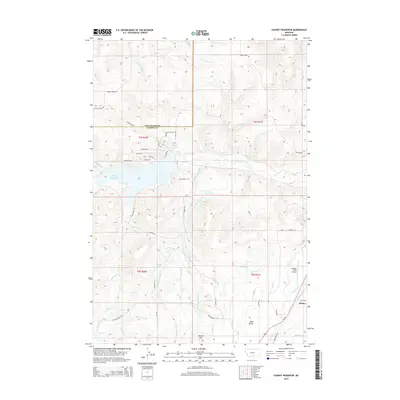
2014 Map of Cooney Reservoir
USGS Topo · Published 2014About this map
Cooney Reservoir serves as the central focal point of this landscape on the border of Stillwater and Carbon counties. This 2014 survey reveals an intricate network of water management, where natural flows like Red Lodge Creek and Willow Cr are diverted into man-made systems such as Hokola Ditch, Cook Ditch, and Saarela Ditch. The geography is defined by the contrast between the elevated Shane Ridge to the north and the expansive West Bench to the south. In the southeastern corner, the settlement of Selmes sits near the junction of Us-212 and the waters of Rock Cr. The map also captures local infrastructure like Bangart Field Airport and the numerous small residential roads encircling the reservoir, reflecting the area's development for recreation and rural living amidst traditional ranching terrain.
Find a feature on this map
54 named features on this map. Tap any name to fly to it.
Don’t see what you’re looking for? This feature index may not catch every label — zoom into the map to look around manually.
Map Details
Editions of this 2014 Cooney Reservoir Map
This is the sole edition of this map. No revisions or reprints were ever made.
Other maps of this area

1892 · Stillwater
USGS Topo · 1:125,000

1932 · Red Lodge No 2
USGS Topo · 1:48,000

1932 · Red Lodge No 1
USGS Topo · 1:48,000

1954 · Billings
USGS Topo · 1:250,000

1955 · Whitebird School
USGS Topo · 1:24,000

1956 · Shane Ridge
USGS Topo · 1:24,000

1956 · Roscoe NE
USGS Topo · 1:24,000

1956 · Rapids
USGS Topo · 1:24,000

1956 · Roberts
USGS Topo · 1:24,000

1956 · Castagne
USGS Topo · 1:24,000