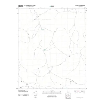
2010 Map of Cooper Canyon
USGS Topo · Published 2010About this map
The White Sands Missile Range dominates this landscape, reflecting the military's significant footprint in New Mexico. The terrain is defined by a series of deep drainages and ridges, including the prominent Iron Mine Ridge and the broad Chupadera Mesa. A network of unpaved routes, such as WSMR S Route 3511 and WSMR S Route 41, connects remote points across the desert floor. Water is a vital resource here, marked by isolated points of infrastructure like the Forest Well Tank, Lobo Tank, and the New Forest Windmill. These features indicate the persistent, low-density ranching and grazing activity that occurs on the periphery of the missile range, evidenced by the presence of Ratliff Ranch. The intricate canyons, such as Yellow Dog Canyon and Aguila Canyon, provide a detailed look at the erosional patterns across this high-desert environment.
Find a feature on this map
22 named features on this map. Tap any name to fly to it.
Don’t see what you’re looking for? This feature index may not catch every label — zoom into the map to look around manually.
Map Details
Editions of this 2010 Cooper Canyon Map
This is the sole edition of this map. No revisions or reprints were ever made.
Other maps of this area

1918 · Oscura Peak
USGS Topo · 1:125,000

1948 · Broken Back Crater
USGS Topo · 1:62,500

1948 · Bingham
USGS Topo · 1:62,500

1954 · Tularosa
USGS Topo · 1:250,000

1954 · Socorro
USGS Topo · 1:250,000

1958 · Socorro
USGS Topo · 1:250,000

1958 · Tularosa
USGS Topo · 1:250,000

1962 · Socorro
USGS Topo · 1:250,000

1972 · Turkey Ridge SW
USGS Topo · 1:24,000

1972 · Wilson Ranch
USGS Topo · 1:24,000