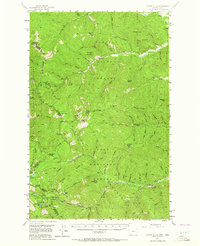
1956 Map of Cooper Gulch
USGS Topo · Published 1964About this map
Thompson Pass and Glidden Pass anchor this mid-century survey of the high Bitterroot Range along the border of Sanders County, Montana, and Shoshone County, Idaho. The landscape is defined by the convergence of the Kaniksu National Forest, Coeur d'Alene National Forest, and Lolo National Forest. This era of documentation reveals a region centered on resource extraction and early mountain transit, most notably at the Montana Mine located near the state line. High-altitude hydrology is a central feature, with the headwaters of Canyon Creek and White Pine Creek carving deep drainages between prominent summits like Haystack Mountain and Sex Peak. The presence of Blossom Lakes and the tiered Upper Glidden Lake and Lower Glidden Lake illustrates the glacial character of these mountain basins before modern development altered the backcountry accessibility of the panhandle region.
Find a feature on this map
46 named features on this map. Tap any name to fly to it.
Don’t see what you’re looking for? This feature index may not catch every label — zoom into the map to look around manually.
Map Details
Editions of this 1956 Cooper Gulch Map
3 editions found

Other maps of this area

1901 · Coeur D'Alene District
USGS Topo · 1:62,500

1903 · Coeur D'Alene District
USGS Topo · 1:62,500

1906 · Coeur D'Alene District
USGS Topo · 1:62,500

1914 · Avery
USGS Topo · 1:125,000

1917 · Avery
USGS Topo · 1:125,000

1918 · St Regis
USGS Topo · 1:125,000

1919 · St. Regis
USGS Topo · 1:125,000

1932 · Trout Creek
USGS Topo · 1:125,000

1935 · Trout Creek
USGS Topo · 1:125,000

1936 · Trout Creek
USGS Topo · 1:125,000