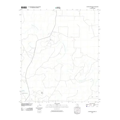
2010 Map of Cooper Mountain
USGS Topo · Published 2010About this map
The Double Mountain Fork Brazos River winds through this West Texas landscape, defining the topography of Kent County near the settlement of Cogdell. This terrain is characterized by its drainage network, where Cooper Creek and Sand Creek feed into the larger river system. The ranching heritage of the region is evident through named landmarks such as the Furr Ranch and the Cogdell Ranch Lake, which is held by the Cogdell Ranch Lake Dam. Rising above the surrounding plains, Cooper Mountain serves as a prominent local landmark, while to the southeast, the terrain drops into the distinctive Eagle Canyon. The map reveals a remote area primarily accessed by a network of county roads including Co RD 413 and Co RD 409, highlighting the intersection of industrial water management and traditional Texas cattle country.
Find a feature on this map
14 named features on this map. Tap any name to fly to it.
Don’t see what you’re looking for? This feature index may not catch every label — zoom into the map to look around manually.
Map Details
Editions of this 2010 Cooper Mountain Map
This is the sole edition of this map. No revisions or reprints were ever made.
Other maps of this area

1932 · Camp Springs
USGS Topo · 1:62,500

1954 · Lubbock
USGS Topo · 1:250,000

1954 · Big Spring
USGS Topo · 1:250,000

1958 · Big Spring
USGS Topo · 1:250,000

1969 · Maverick Creek
USGS Topo · 1:24,000
1969 · Hudd
USGS Topo · 1:24,000

1969 · Cooper Mountain
USGS Topo · 1:24,000

1969 · Clairemont East
USGS Topo · 1:24,000

1969 · Clairemont West
USGS Topo · 1:24,000

1969 · T-O Creek
USGS Topo · 1:24,000