
1969 Map of Cooper Mountain
USGS Topo · Published 1972About this map
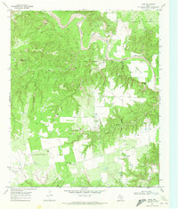
The Double Mountain Fork Brazos River snakes through this West Texas landscape, carving deep relief into the terrain as it winds past the Cogdell Oil Field. This late-1960s survey documents a region defined by its energy and ranching economy, where industrial development is interspersed with wide-open range. Significant petroleum infrastructure is evident throughout the area, marked by numerous Oil Wells and a prominent Pipeline crossing the southern reaches. Local landmarks such as Cooper Mountain and the deep cuts of Eagle Canyon provide natural orientation points for a landscape otherwise dominated by the grid of the oil field and the winding watercourses of Sand Creek and Cooper Creek. The presence of the Parr Ranch and small-scale operations like a Gravel Pit highlight the sparse but persistent settlement patterns of Kent County during this era.
Find a feature on this map
13 named features on this map. Tap any name to fly to it.
Don’t see what you’re looking for? This feature index may not catch every label — zoom into the map to look around manually.
Map Details
Editions of this 1969 Cooper Mountain Map
This is the sole edition of this map. No revisions or reprints were ever made.
Other maps of this area

1932 · Camp Springs
USGS Topo · 1:62,500

1954 · Lubbock
USGS Topo · 1:250,000

1954 · Big Spring
USGS Topo · 1:250,000

1958 · Big Spring
USGS Topo · 1:250,000

1969 · Maverick Creek
USGS Topo · 1:24,000
1969 · Hudd
USGS Topo · 1:24,000

1969 · Clairemont East
USGS Topo · 1:24,000

1969 · Clairemont West
USGS Topo · 1:24,000

1969 · T-O Creek
USGS Topo · 1:24,000
1969 · Gant Hills
USGS Topo · 1:24,000