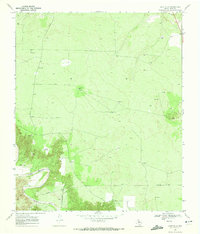
1969 Map of Gant Hills
USGS Topo · Published 1972About this map
The Double Mountain Fork Brazos River winds through the southwestern corner of this West Texas landscape, shaping the local topography with incisions like Eagle Canyon and Cottonwood Draw. In the late 1960s, this area of Kent County remained primarily ranch land, evidenced by the presence of isolated outposts such as South Camp and infrastructure like the Iron Trap Windmill. The namesake Gant Hills rise in the east, while the broader terrain is marked by a scattering of water management features, including a Water Tank and Anderson Well, essential for livestock in this semi-arid environment. Subsurface exploration and resource extraction are visible through numerous labels for Drill Hole sites and a Gravel Pit, alongside a buried Pipeline that cuts across the southern plains, indicating the era's industrial footprint on the rural cattle country.
Find a feature on this map
13 named features on this map. Tap any name to fly to it.
Don’t see what you’re looking for? This feature index may not catch every label — zoom into the map to look around manually.
Map Details
Editions of this 1969 Gant Hills Map
This is the sole edition of this map. No revisions or reprints were ever made.
Other maps of this area

1926 · Snyder 1-a
USGS Topo · 1:48,000

1932 · Camp Springs
USGS Topo · 1:62,500

1954 · Lubbock
USGS Topo · 1:250,000

1954 · Big Spring
USGS Topo · 1:250,000

1958 · Big Spring
USGS Topo · 1:250,000
1969 · A B C Creek
USGS Topo · 1:24,000

1969 · Maverick Creek
USGS Topo · 1:24,000
1969 · Hudd
USGS Topo · 1:24,000

1969 · Cooper Mountain
USGS Topo · 1:24,000

1969 · Clairemont East
USGS Topo · 1:24,000