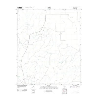
2012 Map of Cooper Mountain
USGS Topo · Published 2012About this map
The Double Mountain Fork Brazos River carves a winding path across this West Texas landscape, defining the local hydrology alongside tributaries like Sand Cr and Cooper Cr. The terrain is punctuated by Copper Mtn, a prominent high point in this Kent County region. This 2012 survey illustrates a sparsely populated ranching environment where large holdings like Furr Ranch and the area near Cogdell Ranch Lake are the primary landmarks. Transportation in the area relies on a network of county roads, including Co RD-409 and Co RD-316, which connect isolated homesteads to larger routes like FM-1142. The map provides a clear look at the relationship between the rugged watercourse and the rural road system used by generations of Texas ranchers.
Find a feature on this map
11 named features on this map. Tap any name to fly to it.
Don’t see what you’re looking for? This feature index may not catch every label — zoom into the map to look around manually.
Map Details
Editions of this 2012 Cooper Mountain Map
This is the sole edition of this map. No revisions or reprints were ever made.
Other maps of this area

1932 · Camp Springs
USGS Topo · 1:62,500

1954 · Lubbock
USGS Topo · 1:250,000

1954 · Big Spring
USGS Topo · 1:250,000

1958 · Big Spring
USGS Topo · 1:250,000

1969 · Maverick Creek
USGS Topo · 1:24,000
1969 · Hudd
USGS Topo · 1:24,000

1969 · Cooper Mountain
USGS Topo · 1:24,000

1969 · Clairemont East
USGS Topo · 1:24,000

1969 · Clairemont West
USGS Topo · 1:24,000

1969 · T-O Creek
USGS Topo · 1:24,000