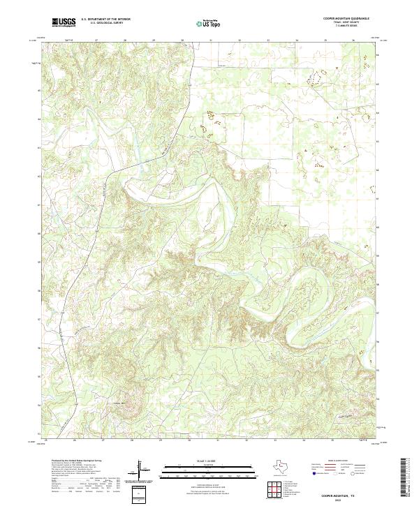
2022 Map of Cooper Mountain
USGS Topo · Published 2022About this map
The Double Mountain Fork Brazos River carves a complex drainage network through this Kent County landscape, defining the local topography with a series of sharp bends and tributary confluences. Prominent landforms such as Cooper Mtn and the deep incisions of Eagle Canyon illustrate the erosive power of the river system over time. The drainage pattern is further reinforced by Cooper Cr and Sand Cr, which feed into the primary river valley. Human presence is marked by a sparse but essential road network, including Ranch Rd 1231 and Harrington Ranch Rd, which navigate the varying elevations and follow the natural contours of the river breaks. This modern survey reflects the enduring character of the Texas Rolling Plains, where large-scale ranching and natural watercourses remain the dominant features of the land.
Find a feature on this map
11 named features on this map. Tap any name to fly to it.
Don’t see what you’re looking for? This feature index may not catch every label — zoom into the map to look around manually.
Map Details
Editions of this 2022 Cooper Mountain Map
This is the sole edition of this map. No revisions or reprints were ever made.
Other maps of this area

1932 · Camp Springs
USGS Topo · 1:62,500

1954 · Lubbock
USGS Topo · 1:250,000

1954 · Big Spring
USGS Topo · 1:250,000

1958 · Big Spring
USGS Topo · 1:250,000

1969 · Maverick Creek
USGS Topo · 1:24,000
1969 · Hudd
USGS Topo · 1:24,000

1969 · Cooper Mountain
USGS Topo · 1:24,000

1969 · Clairemont East
USGS Topo · 1:24,000

1969 · Clairemont West
USGS Topo · 1:24,000

1969 · T-O Creek
USGS Topo · 1:24,000