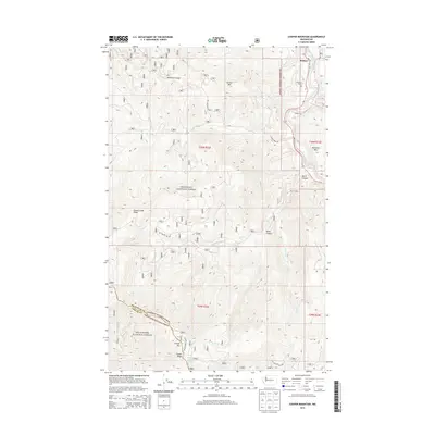
2014 Map of Cooper Mountain
USGS Topo · Published 2014About this map
The Methow River corridor serves as the primary artery of activity in this 2014 survey of the high country where Chelan and Okanogan counties meet. The small settlement of Methow is situated in the northeastern corner, accompanied by the Methow Cem, reflecting the area's established local history along the river valley. Most of the map spans the protected lands of the Okanogan National Forest and Wenatchee National Forest, illustrating a landscape defined by significant peaks and drainage systems. Notable summits like Cooper Mtn and Buckhorn Mtn dominate the terrain, while narrow passages like Black Canyon and Mulhollan Gulch carve through the ridges. Remote water sources, including Gold Spring and Cooper Corral Spring, are interspersed among forest roads such as Burma Rd and Squaw Creek Rd, which provide access to these isolated forest sections.
Find a feature on this map
31 named features on this map. Tap any name to fly to it.
Don’t see what you’re looking for? This feature index may not catch every label — zoom into the map to look around manually.
Map Details
Editions of this 2014 Cooper Mountain Map
This is the sole edition of this map. No revisions or reprints were ever made.
Other maps of this area

1899 · Methow
USGS Topo · 1:125,000

1901 · Chelan
USGS Topo · 1:125,000

1901 · Methow
USGS Topo · 1:125,000

1905 · Okanogan
USGS Topo · 1:125,000

1953 · Ritzville
USGS Topo · 1:250,000

1954 · Okanogan
USGS Topo · 1:250,000

1955 · Concrete
USGS Topo · 1:250,000

1957 · Brewster
USGS Topo · 1:62,500

1957 · Wenatchee
USGS Topo · 1:250,000

1958 · Concrete
USGS Topo · 1:250,000