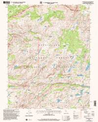
2001 Map of Cooper Peak
USGS Topo · Published 2004About this map
The Stanislaus National Forest landscape shown here is defined by an intricate network of high-altitude basins and meadows within the Emigrant Wilderness. These granite-carved spaces served as essential summer grazing grounds and transit routes through the High Sierra, evidenced by family-named and descriptive landmarks like Whitesides Meadow, Studhorse Meadow, and Hay Meadow. The hydrology of the region is centered on the South Fork Stanislaus River and Cherry Creek, which feed a dense cluster of alpine lakes including Chewing Gum Lake, Leopold Lake, and Jewelry Lake. Historically, the area was monitored from the Summit Meadow Ranger District, which oversaw the trails and wilderness boundaries near prominent peaks such as Cooper Peak and Burst Rock. The prevalence of meadows and passes like Eagle Pass highlights the traditional seasonal movement of people and livestock through this part of Tuolumne County.
Find a feature on this map
57 named features on this map. Tap any name to fly to it.
Don’t see what you’re looking for? This feature index may not catch every label — zoom into the map to look around manually.
Map Details
Editions of this 2001 Cooper Peak Map
2 editions found
Other maps of this area

1896 · Dardanelles
USGS Topo · 1:125,000

1898 · Dardanelles
USGS Topo · 1:125,000

1948 · Walker Lake
USGS Topo · 1:250,000

1956 · Dardanelles Cone
USGS Topo · 1:62,500

1956 · Pinecrest
USGS Topo · 1:62,500

1956 · Sonora Pass
USGS Topo · 1:62,500
1956 · Tower Peak
USGS Topo · 1:62,500

1957 · Walker Lake
USGS Topo · 1:250,000

1962 · Walker Lake
USGS Topo · 1:250,000

1964 · Walker Lake
USGS Topo · 1:250,000