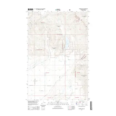
2014 Map of Coopers Lake
USGS Topo · Published 2014About this map
Lolo National Forest and Helena National Forest converge in this high-elevation landscape, where the North Fork Blackfoot River carves through the terrain. The central valley is defined by Kleinschmidt Flat, a notable geological feature that stands in contrast to the surrounding peaks like Echo Mtn and the crossing at Echo Pass. Water management for earlier ranching or agricultural efforts is evident through the presence of the Old Lund Ditch and Jorgenson Ditch, which trace the contours near Bear Creek. The map shows a transition from the wilderness of the national forests to the small settlements and seasonal outposts of Deer Park, connected by a network of ranch roads such as White Tail Ranch Rd and Cooper Lake Rd that lead toward the prominent Coopers Lake.
Find a feature on this map
51 named features on this map. Tap any name to fly to it.
Don’t see what you’re looking for? This feature index may not catch every label — zoom into the map to look around manually.
Map Details
Editions of this 2014 Coopers Lake Map
This is the sole edition of this map. No revisions or reprints were ever made.
Other maps of this area

1889 · Helena
USGS Topo · 1:250,000

1893 · Helena
USGS Topo · 1:250,000

1899 · Helena
USGS Topo · 1:250,000

1902 · Ovando
USGS Topo · 1:125,000

1903 · Coopers Lake
USGS Topo · 1:125,000

1903 · Helena
USGS Topo · 1:250,000

1905 · Ovando
USGS Topo · 1:125,000

1919 · Drummond
USGS Topo · 1:125,000

1921 · Drummond
USGS Topo · 1:125,000

1947 · Butte
USGS Topo · 1:250,000