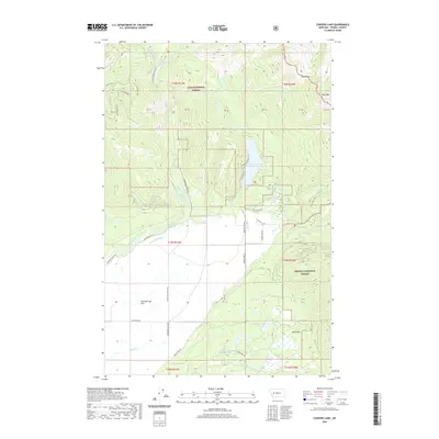
2020 Map of Coopers Lake
USGS Topo · Published 2020About this map
Coopers Lake serves as a central landmark in this 2020 landscape where the high timberlands of the Lolo National Forest and Helena National Forest converge. The terrain is defined by the sharp transition between the mountain peaks of the Wilkie Divide and the open expanse of Kleinschmidt Flat. Water management is evident throughout the drainage of the North Fork Blackfoot River, where the Jorgenson Ditch and Old Lund Ditch cut through the valley floor to support local ranching. High-altitude meadows like Madison Meadow and Deer Park are scattered among the ridges, while established routes such as Cooper Lake Rd and the Dry Creek Trail provide access to the remote interior. This modern survey documents the persistent boundary between protected wilderness and the working landscapes of the Rocky Mountain front.
Find a feature on this map
56 named features on this map. Tap any name to fly to it.
Don’t see what you’re looking for? This feature index may not catch every label — zoom into the map to look around manually.
Map Details
Editions of this 2020 Coopers Lake Map
This is the sole edition of this map. No revisions or reprints were ever made.
Other maps of this area

1889 · Helena
USGS Topo · 1:250,000

1893 · Helena
USGS Topo · 1:250,000

1899 · Helena
USGS Topo · 1:250,000

1902 · Ovando
USGS Topo · 1:125,000

1903 · Coopers Lake
USGS Topo · 1:125,000

1903 · Helena
USGS Topo · 1:250,000

1905 · Ovando
USGS Topo · 1:125,000

1919 · Drummond
USGS Topo · 1:125,000

1921 · Drummond
USGS Topo · 1:125,000

1947 · Butte
USGS Topo · 1:250,000