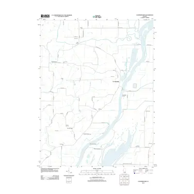
2012 Map of Cooperstown
USGS Topo · Published 2012About this map
The Illinois River corridor dominates the eastern landscape, carving a path past La Grange Island and Meredosia Island while defining the low-lying wetlands of Hancock Slough. In the uplands near Cooperstown, a dense network of county roads such as Co HWY-3 and Co RD-1550 connects agricultural fields and rural residences. This region is remarkably well-documented for genealogists, featuring numerous local burial grounds including Mount Zion Cem, Adams Cem, and the Lavina Henry Cem. Further south, Meredosia Lake and Twin Ponds mark the intricate water systems adjacent to the main river channel. Local transportation and infrastructure are represented by the LaGrange Lock Rd, the Sneider Landing Strip, and Kloker Airport. This 2012 record captures a community defined by its proximity to significant waterways and a landscape dotted with historical family landmarks.
Find a feature on this map
73 named features on this map. Tap any name to fly to it.
Don’t see what you’re looking for? This feature index may not catch every label — zoom into the map to look around manually.
Map Details
Editions of this 2012 Cooperstown Map
This is the sole edition of this map. No revisions or reprints were ever made.
Other maps of this area

1923 · Rushville
USGS Topo · 1:62,500

1926 · Beardstown
USGS Topo · 1:62,500

1926 · Rushville
USGS Topo · 1:62,500

1928 · Meredosia
USGS Topo · 1:62,500

1929 · Arenzville
USGS Topo · 1:62,500

1931 · Meredosia
USGS Topo · 1:62,500

1932 · Arenzville
USGS Topo · 1:62,500

1944 · Beardstown
USGS Topo · 1:62,500

1948 · Quincy
USGS Topo · 1:250,000

1956 · Quincy
USGS Topo · 1:250,000