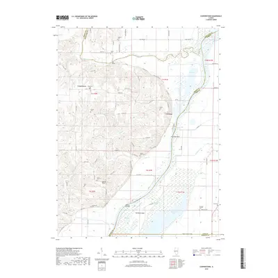
2018 Map of Cooperstown
USGS Topo · Published 2018About this map
Cooperstown and the surrounding river bottomlands are documented here at a time when the Illinois River and La Moine River systems defined the local geography of Brown and Cass Counties. The land is characterized by extensive wetlands and sloughs, including the notable Hancock Slough and Meredosia Lake, which sit adjacent to the sprawling Meredosia Island. The agricultural uplands rise above the floodplains, marked by several small family and community burial grounds such as Adams Cem, Vandeventer Cem, and Hulett Cem. Local connectivity is maintained through landmarks like Star Bridge over the La Moine River and the small settlement at La Grange. The map reveals a landscape of complex water management and rural settlement, where islands like Moores Towhead and named ridges such as Spunky Ridge break up the low-lying river valleys.
Find a feature on this map
85 named features on this map. Tap any name to fly to it.
Don’t see what you’re looking for? This feature index may not catch every label — zoom into the map to look around manually.
Map Details
Editions of this 2018 Cooperstown Map
This is the sole edition of this map. No revisions or reprints were ever made.
Other maps of this area

1923 · Rushville
USGS Topo · 1:62,500

1926 · Beardstown
USGS Topo · 1:62,500

1926 · Rushville
USGS Topo · 1:62,500

1928 · Meredosia
USGS Topo · 1:62,500

1929 · Arenzville
USGS Topo · 1:62,500

1931 · Meredosia
USGS Topo · 1:62,500

1932 · Arenzville
USGS Topo · 1:62,500

1944 · Beardstown
USGS Topo · 1:62,500

1948 · Quincy
USGS Topo · 1:250,000

1956 · Quincy
USGS Topo · 1:250,000