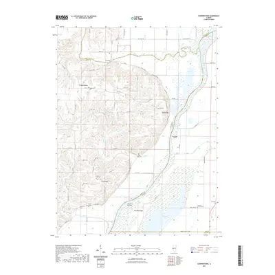
2021 Map of Cooperstown
USGS Topo · Published 2021About this map
Cooperstown and the riverfront settlement of La Grange anchor this detailed study of Brown County’s eastern edge. The landscape is defined by the convergence of the La Moine River and the Illinois River, creating a complex network of wetlands and backwaters such as Hancock Slough, Twin Ponds, and the wide expanse of Meredosia Lake. The topography shifts from the flat river valley bottomlands of La Grange Island and Meredosia Island to the higher elevations of Spunky Ridge, where several small tributaries like Baehr Br and Little Cr have carved out the terrain.
Find a feature on this map
80 named features on this map. Tap any name to fly to it.
Don’t see what you’re looking for? This feature index may not catch every label — zoom into the map to look around manually.
Map Details
Editions of this 2021 Cooperstown Map
This is the sole edition of this map. No revisions or reprints were ever made.
Other maps of this area

1923 · Rushville
USGS Topo · 1:62,500

1926 · Beardstown
USGS Topo · 1:62,500

1926 · Rushville
USGS Topo · 1:62,500

1928 · Meredosia
USGS Topo · 1:62,500

1929 · Arenzville
USGS Topo · 1:62,500

1931 · Meredosia
USGS Topo · 1:62,500

1932 · Arenzville
USGS Topo · 1:62,500

1944 · Beardstown
USGS Topo · 1:62,500

1948 · Quincy
USGS Topo · 1:250,000

1956 · Quincy
USGS Topo · 1:250,000