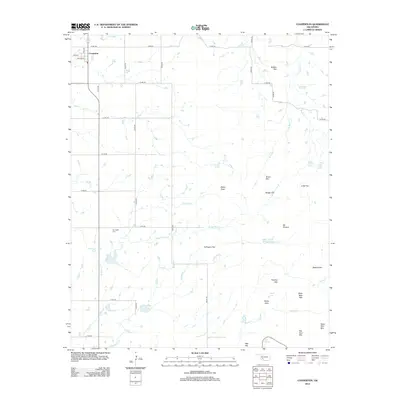
2012 Map of Cooperton
USGS Topo · Published 2012About this map
Cooperton stands at the northwestern corner of this Kiowa County landscape, where the grid of rural roads meets the base of several prominent peaks and ridges. The terrain transitions from the relatively flat expanses of Fullingim Flat and Boggy Flat to a series of distinctive granite rises including Buffalo Mtn, Grace Mtn, and the aptly named Dead Man Mtn. This intersection of plains and peaks creates a geography defined by scattered springs and intermittent creeks, such as Time-O-Day Spring and Sugar Creek Spring.
Find a feature on this map
50 named features on this map. Tap any name to fly to it.
Don’t see what you’re looking for? This feature index may not catch every label — zoom into the map to look around manually.
Map Details
Editions of this 2012 Cooperton Map
This is the sole edition of this map. No revisions or reprints were ever made.
Other maps of this area

1937 · Cache
USGS Topo · 1:48,000

1937 · Quanah Mountain
USGS Topo · 1:24,000

1942 · Cache
USGS Topo · 1:62,500

1949 · Cooperton
USGS Topo · 1:62,500

1949 · Quanah Mountain
USGS Topo · 1:24,000

1950 · Snyder
USGS Topo · 1:62,500

1950 · Saddle Mountain
USGS Topo · 1:62,500

1955 · Lawton
USGS Topo · 1:250,000

1956 · Glen Mountains
USGS Topo · 1:24,000

1956 · Saddle Mountain
USGS Topo · 1:24,000