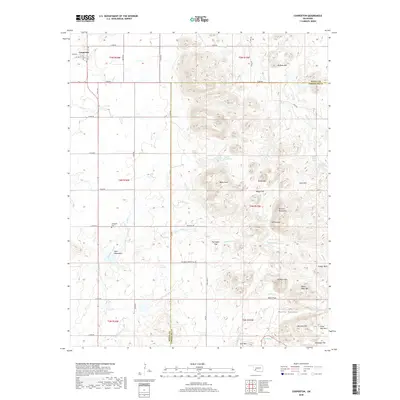
2018 Map of Cooperton
USGS Topo · Published 2018About this map
Cooperton stands as the primary settlement on this landscape, where the flat agricultural plains of the west meet the prominent rises of the Wichita Mountains and Glen Mountains to the east. The terrain transitions from the grid-aligned ranch roads like e1480 RD and Butler ST into a complex system of peaks and valleys. Prominent high points such as Mt Pinchot, Baker Peak, and Grace Mtn dominate the horizon, while the lowlands are characterized by expansive level areas like Boggy Flat and Fullingim Flat. This area is defined by its numerous natural water sources, including Time-O-Day Spring and Buffalo Spring, which historically supported the region's ranching operations. Genealogists may find interest in the Springhill Cem, located just north of the mountains near the banks of East Otter Creek. The map also captures the various forks of Sugar Cr and Telephone Cr as they navigate the rocky canyons of the southeast.
Find a feature on this map
55 named features on this map. Tap any name to fly to it.
Don’t see what you’re looking for? This feature index may not catch every label — zoom into the map to look around manually.
Map Details
Editions of this 2018 Cooperton Map
This is the sole edition of this map. No revisions or reprints were ever made.
Other maps of this area

1937 · Cache
USGS Topo · 1:48,000

1937 · Quanah Mountain
USGS Topo · 1:24,000

1942 · Cache
USGS Topo · 1:62,500

1949 · Cooperton
USGS Topo · 1:62,500

1949 · Quanah Mountain
USGS Topo · 1:24,000

1950 · Snyder
USGS Topo · 1:62,500

1950 · Saddle Mountain
USGS Topo · 1:62,500

1955 · Lawton
USGS Topo · 1:250,000

1956 · Glen Mountains
USGS Topo · 1:24,000

1956 · Saddle Mountain
USGS Topo · 1:24,000