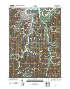
2011 Map of Coos Bay
USGS Topo · Published 2011About this map
Coos Bay and its surrounding water-bound communities are defined by a complex network of sloughs and channels that snake through the coastal landscape. In the northern reaches, the Coos River splits into the Cooston Channel and the main Marshfield Channel, framing industrial and residential zones like Eastside and Englewood. The presence of several historic burial grounds, including the Independent Order of Odd Fellows Cemetery near Telegraph Hill and the Sumner Pioneer Cemetery to the southeast, reflects the deep-rooted settlement history of this maritime region. Further south, the landscape transitions into more rural outposts such as Libby, Millington, and Delmar, which are linked by winding roads like Old Wagon Rd and Coos Sumner Ln. This map highlights how transportation relied heavily on crossings like the Chandler Bridge and the Coos City Bridge to navigate the pervasive tidal waters of Isthmus Slough and Catching Slough.
Find a feature on this map
87 named features on this map. Tap any name to fly to it.
Don’t see what you’re looking for? This feature index may not catch every label — zoom into the map to look around manually.
Map Details
Editions of this 2011 Coos Bay Map
This is the sole edition of this map. No revisions or reprints were ever made.
Other maps of this area

1896 · Coos Bay
USGS Topo · 1:125,000

1898 · Coos Bay
USGS Topo · 1:125,000

1900 · Coos Bay
USGS Topo · 1:125,000

1942 · Empire
USGS Topo · 1:62,500

1942 · Coquille
USGS Topo · 1:62,500

1942 · Coos Bay
USGS Topo · 1:62,500

1943 · Bandon
USGS Topo · 1:62,500

1944 · Empire
USGS Topo · 1:62,500

1944 · Bandon
USGS Topo · 1:62,500

1945 · Coquille
USGS Topo · 1:62,500