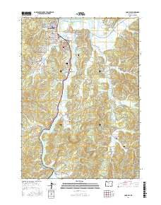
2017 Map of Coos Bay
USGS Topo · Published 2017About this map
Coos Bay and its intricate network of waterways dominate this 2017 survey, where the Central Oregon & Pacific RR skirts the shoreline of Isthmus Slough. The coastal landscape is defined by deep-water channels like the Marshfield Channel and the winding Catching Slough, reflecting a community built around maritime commerce and timber transport. Smaller residential developments and neighborhoods such as Englewood, Eastside, and Millington are clustered along the inlets and ridges, while the southern reaches of the map transition into a more fragmented topography of gulches and sloughs.
Find a feature on this map
164 named features on this map. Tap any name to fly to it.
Don’t see what you’re looking for? This feature index may not catch every label — zoom into the map to look around manually.
Map Details
Editions of this 2017 Coos Bay Map
This is the sole edition of this map. No revisions or reprints were ever made.
Other maps of this area

1896 · Coos Bay
USGS Topo · 1:125,000

1898 · Coos Bay
USGS Topo · 1:125,000

1900 · Coos Bay
USGS Topo · 1:125,000

1942 · Empire
USGS Topo · 1:62,500

1942 · Coquille
USGS Topo · 1:62,500

1942 · Coos Bay
USGS Topo · 1:62,500

1943 · Bandon
USGS Topo · 1:62,500

1944 · Empire
USGS Topo · 1:62,500

1944 · Bandon
USGS Topo · 1:62,500

1945 · Coquille
USGS Topo · 1:62,500