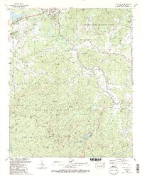
1988 Map of Coosa Bald
USGS Topo · Published 1988About this map
Blairsville serves as a gateway to the Blue Ridge high country in this late-1980s landscape, where the Nottely River flows northward toward Nottely Lake. The topography is dominated by the ridges and gaps of the Chattahoochee National Forest, including the high peak of Coosa Bald. Settlement patterns follow the valley floors, particularly around Choestoe and along the various creeks like Arkaqua and Coosa.
Find a feature on this map
117 named features on this map. Tap any name to fly to it.
Don’t see what you’re looking for? This feature index may not catch every label — zoom into the map to look around manually.
Map Details
Editions of this 1988 Coosa Bald Map
2 editions found
Other maps of this area

1886 · Dahlonega
USGS Topo · 1:125,000

1888 · Ellijay
USGS Topo · 1:125,000

1892 · Dahlonega
USGS Topo · 1:125,000

1892 · Ellijay
USGS Topo · 1:125,000

1896 · Dahlonega
USGS Topo · 1:125,000

1898 · Ellijay
USGS Topo · 1:125,000

1903 · Dahlonega
USGS Topo · 1:125,000

1911 · Ellijay
USGS Topo · 1:125,000

1935 · Coosa Bald
USGS Topo · 1:24,000

1935 · Ivylog
USGS Topo · 1:24,000