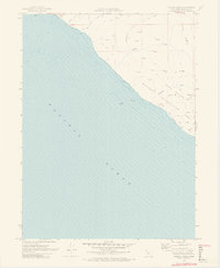
1969 Map of Cooskie Creek
USGS Topo · Published 1974About this map
The Point Gorda Lighthouse stands as a lonely landmark on this 1969 survey of California's lost coast, where the steep terrain of the King Range National Conservation Area meets the Pacific Ocean. The map reveals a wild, unpopulated landscape defined by dramatic elevation changes and remote coastal features like Gorda Rock and the offshore hazards of Rodgers Break.
Find a feature on this map
22 named features on this map. Tap any name to fly to it.
Don’t see what you’re looking for? This feature index may not catch every label — zoom into the map to look around manually.
Map Details
Editions of this 1969 Cooskie Creek Map
3 editions found
Other maps of this area

1919 · Glynn
USGS Topo · 1:62,500

1920 · Pt. Delagda
USGS Topo · 1:62,500

1921 · Cape Mendocino
USGS Topo · 1:62,500

1926 · Gorda
USGS Topo · 1:62,500

1949 · Eureka
USGS Topo · 1:250,000

1949 · Point Delgada
USGS Topo · 1:62,500

1950 · Cape Mendocino
USGS Topo · 1:62,500

1950 · Scotia
USGS Topo · 1:62,500

1951 · Scotia
USGS Topo · 1:62,500

1951 · Point Delgada
USGS Topo · 1:62,500