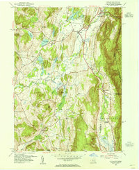
1953 Map of Copake
USGS Topo · Published 1955About this map
Roeliff Jansen Kill and the Noster Kill wind through the valleys of eastern Columbia County, anchoring a landscape defined by its dairy farms and iron mining history. The settlement at Copake Falls sits at the foot of Washburn Mountain, while the Central railroad corridor connects the smaller hamlets of Boston Corner and Whitehouse Crossing along the southern border. The terrain rises sharply toward the east into Mount Washington State Park, where a Lookout Tower stands on the heights near Alander Mtn.
Find a feature on this map
46 named features on this map. Tap any name to fly to it.
Don’t see what you’re looking for? This feature index may not catch every label — zoom into the map to look around manually.
Map Details
Editions of this 1953 Copake Map
4 editions found
Other maps of this area

1885 · Sheffield
USGS Topo · 1:62,500

1888 · Sheffield
USGS Topo · 1:62,500

1891 · Sheffield
USGS Topo · 1:62,500

1892 · Cornwall
USGS Topo · 1:62,500

1893 · Sheffield
USGS Topo · 1:62,500

1893 · Cornwall
USGS Topo · 1:62,500

1897 · Sheffield
USGS Topo · 1:62,500

1899 · Housatonic
USGS Topo · 1:125,000

1899 · Millbrook
USGS Topo · 1:62,500

1900 · Housatonic
USGS Topo · 1:125,000