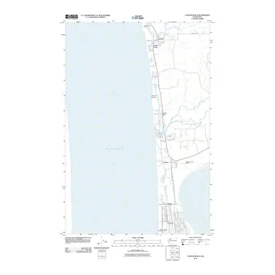
2011 Map of Copalis Beach
USGS Topo · Published 2011About this map
Copalis Beach and its neighboring coastal communities occupy a narrow, ecologically complex strip of land between the Pacific Ocean and a network of freshwater drainage systems. This 2011 survey illustrates the concentrated development at the southern tip of the peninsula in Ocean Shores, where a dense grid of residential streets like Magellan Ave NE and Copalis Ave NE surrounds the elongated waters of Duck Lake.
Find a feature on this map
50 named features on this map. Tap any name to fly to it.
Don’t see what you’re looking for? This feature index may not catch every label — zoom into the map to look around manually.
Map Details
Editions of this 2011 Copalis Beach Map
This is the sole edition of this map. No revisions or reprints were ever made.
Other maps of this area

1938 · Moclips
USGS Topo · 1:62,500

1941 · Moclips
USGS Topo · 1:62,500

1941 · Grayland
USGS Topo · 1:62,500

1943 · Copalis Beach
USGS Topo · 1:250,000

1951 · Copalis Beach
USGS Topo · 1:250,000

1955 · Point Brown
USGS Topo · 1:24,000

1955 · Carlisle
USGS Topo · 1:24,000

1955 · Copalis Beach
USGS Topo · 1:24,000
1955 · Moclips
USGS Topo · 1:24,000

1956 · Copalis Crossing
USGS Topo · 1:24,000