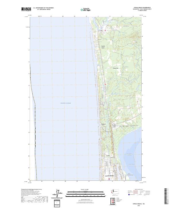
2023 Map of Copalis Beach
USGS Topo · Published 2023About this map
The Copalis River flows into the Pacific Ocean just north of Copalis Beach, defining a coastal landscape where low-lying wetlands meet the sea. This contemporary survey shows the dense residential grid of Ocean Shores at the southern tip of the peninsula, contrasting with the more linear settlement patterns of Oyehut and Ocean City further north along Ocean Blvd. The map reveals the intricate water network that shapes the region, from the tidal Oyehut Channel in Grays Harbor North Bay to inland features like Lang Lake and Cranberry Creek.
Find a feature on this map
35 named features on this map. Tap any name to fly to it.
Don’t see what you’re looking for? This feature index may not catch every label — zoom into the map to look around manually.
Map Details
Editions of this 2023 Copalis Beach Map
This is the sole edition of this map. No revisions or reprints were ever made.
Other maps of this area

1938 · Moclips
USGS Topo · 1:62,500

1941 · Moclips
USGS Topo · 1:62,500

1941 · Grayland
USGS Topo · 1:62,500

1943 · Copalis Beach
USGS Topo · 1:250,000

1951 · Copalis Beach
USGS Topo · 1:250,000

1955 · Point Brown
USGS Topo · 1:24,000

1955 · Carlisle
USGS Topo · 1:24,000

1955 · Copalis Beach
USGS Topo · 1:24,000
1955 · Moclips
USGS Topo · 1:24,000

1956 · Copalis Crossing
USGS Topo · 1:24,000