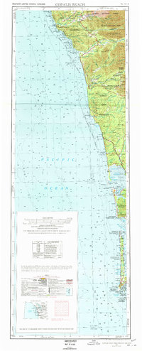
1957 Map of Copalis Beach
USGS Topo · Published 1978About this map
The Pacific coastline from the Columbia River north to La Push is captured here during a period of transition for Washington's coastal communities. The landscape is defined by its deep relationship with the sea and the timber industry, shown by the network of roads and the presence of a Dismantled RR trailing inland from Taholah. Extensive tribal lands, including the Quinault Indian Reservation and Hoh Indian Res, occupy significant stretches of the shore, while the interior is dominated by the southern reaches of Olympic National Park.
Find a feature on this map
74 named features on this map. Tap any name to fly to it.
Don’t see what you’re looking for? This feature index may not catch every label — zoom into the map to look around manually.
Map Details
Editions of this 1957 Copalis Beach Map
2 editions found

Other maps of this area

1918 · Lake Crescent
USGS Topo · 1:62,500

1919 · Astoria
USGS Topo · 1:62,500

1921 · Quinault Lake
USGS Topo · 1:62,500

1922 · Pysht
USGS Topo · 1:62,500

1922 · Lake Crescent
USGS Topo · 1:62,500

1935 · Ozette Lake
USGS Topo · 1:62,500

1935 · Lake Pleasant
USGS Topo · 1:62,500

1938 · Cape Disappointment
USGS Topo · 1:62,500

1938 · Cape Shoalwater
USGS Topo · 1:62,500

1938 · Fort Columbia
USGS Topo · 1:62,500