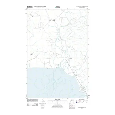
2011 Map of Copalis Crossing
USGS Topo · Published 2011About this map
Copalis Crossing serves as a central point in this coastal landscape, where the Copalis Crossing Post Office anchors a rural network of roads and waterways. The map illustrates a complex drainage system into North Bay, dominated by the winding path of the Humptulips River and its numerous sloughs, including Kurtz Slough and Jessie Slough. To the south, the Campbell Slough Dam regulates the water flow near the settlement of Burrows, while Gray Gables sits further south along the shore.
Find a feature on this map
45 named features on this map. Tap any name to fly to it.
Don’t see what you’re looking for? This feature index may not catch every label — zoom into the map to look around manually.
Map Details
Editions of this 2011 Copalis Crossing Map
This is the sole edition of this map. No revisions or reprints were ever made.
Other maps of this area

1938 · Moclips
USGS Topo · 1:62,500

1941 · Moclips
USGS Topo · 1:62,500

1941 · Grayland
USGS Topo · 1:62,500

1943 · Humptulips
USGS Topo · 1:62,500

1943 · Copalis Beach
USGS Topo · 1:250,000

1951 · Copalis Beach
USGS Topo · 1:250,000

1953 · Hoquiam
USGS Topo · 1:250,000

1955 · Humptulips
USGS Topo · 1:62,500

1955 · Point Brown
USGS Topo · 1:24,000

1955 · Carlisle
USGS Topo · 1:24,000