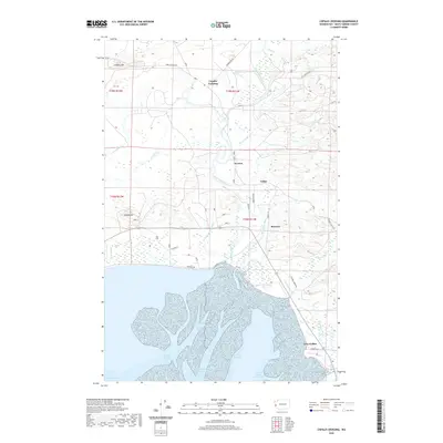
2020 Map of Copalis Crossing
USGS Topo · Published 2020About this map
The Humptulips River dominates this coastal landscape as it winds toward the North Bay of Grays Harbor. This 2020 map documents the intricate wetland and estuarine systems of the Washington coast, where tidal channels like Campbell Slough and Chenois Creek Channel weave through the salt marshes. Inland, small settlements such as Copalis Crossing, Newton, and Tulips are scattered across the terrain, connected by local routes like Copalis Beach Rd and Chenois Valley Rd.
Find a feature on this map
43 named features on this map. Tap any name to fly to it.
Don’t see what you’re looking for? This feature index may not catch every label — zoom into the map to look around manually.
Map Details
Editions of this 2020 Copalis Crossing Map
This is the sole edition of this map. No revisions or reprints were ever made.
Other maps of this area

1938 · Moclips
USGS Topo · 1:62,500

1941 · Moclips
USGS Topo · 1:62,500

1941 · Grayland
USGS Topo · 1:62,500

1943 · Humptulips
USGS Topo · 1:62,500

1943 · Copalis Beach
USGS Topo · 1:250,000

1951 · Copalis Beach
USGS Topo · 1:250,000

1953 · Hoquiam
USGS Topo · 1:250,000

1955 · Humptulips
USGS Topo · 1:62,500

1955 · Point Brown
USGS Topo · 1:24,000

1955 · Carlisle
USGS Topo · 1:24,000