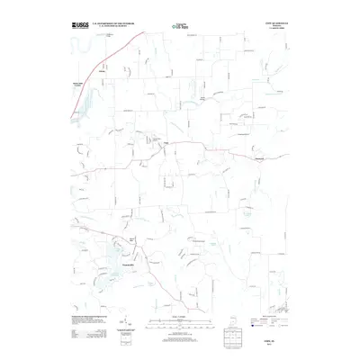
2013 Map of Cope
USGS Topo · Published 2013About this map
Painted Hills and its surrounding water bodies, including Painted Hills Lake and Little Nebo Lake, anchor the southern portion of this region. The terrain is defined by a dense network of waterways like Stotts Cr and its various prongs, which drain the land toward the White River in the northwest. In the northern section, the Henderson Bridge crosses the river near the small settlement of Adams. Several small airfields, such as Twelve Oaks Airport, Jungclause Airport, and Donica Field Airport, are scattered across the landscape, suggesting a local aviation presence among the rural homesteads. Significant elevations like Mount Nebo and the depression known as Skunk Hollow provide topographical variety to this Indiana landscape. The settlement patterns follow a mix of traditional crossroads like Cope and Chetwynd and more modern residential developments near the lakes.
Find a feature on this map
143 named features on this map. Tap any name to fly to it.
Don’t see what you’re looking for? This feature index may not catch every label — zoom into the map to look around manually.
Map Details
Editions of this 2013 Cope Map
This is the sole edition of this map. No revisions or reprints were ever made.
Other maps of this area

1942 · Franklin
USGS Topo · 1:125,000

1947 · Franklin
USGS Topo · 1:62,500

1948 · Trafalgar
USGS Topo · 1:24,000

1948 · Hindustan
USGS Topo · 1:24,000

1948 · Fruitdale
USGS Topo · 1:24,000

1948 · Morgantown
USGS Topo · 1:24,000

1950 · Morgantown
USGS Topo · 1:24,000

1950 · Franklin
USGS Topo · 1:62,500

1952 · Bargersville
USGS Topo · 1:24,000

1953 · Indianapolis
USGS Topo · 1:250,000