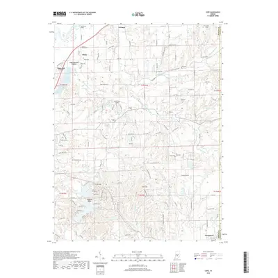
2019 Map of Cope
USGS Topo · Published 2019About this map
Morgantown anchors the southeastern corner of this Morgan County landscape, where the terrain begins to transition from the river bottomlands into a series of ridges and hollows. The White River cuts through the northwest, bridged at Henderson Bridge near the small settlement of Adams. This 2019 survey illustrates the established rural character of the region, marked by numerous family-named cemeteries and small landing strips such as Twelve Oaks Airport and Jungclaus Airport.
Find a feature on this map
133 named features on this map. Tap any name to fly to it.
Don’t see what you’re looking for? This feature index may not catch every label — zoom into the map to look around manually.
Map Details
Editions of this 2019 Cope Map
This is the sole edition of this map. No revisions or reprints were ever made.
Other maps of this area

1942 · Franklin
USGS Topo · 1:125,000

1947 · Franklin
USGS Topo · 1:62,500

1948 · Trafalgar
USGS Topo · 1:24,000

1948 · Hindustan
USGS Topo · 1:24,000

1948 · Fruitdale
USGS Topo · 1:24,000

1948 · Morgantown
USGS Topo · 1:24,000

1950 · Morgantown
USGS Topo · 1:24,000

1950 · Franklin
USGS Topo · 1:62,500

1952 · Bargersville
USGS Topo · 1:24,000

1953 · Indianapolis
USGS Topo · 1:250,000