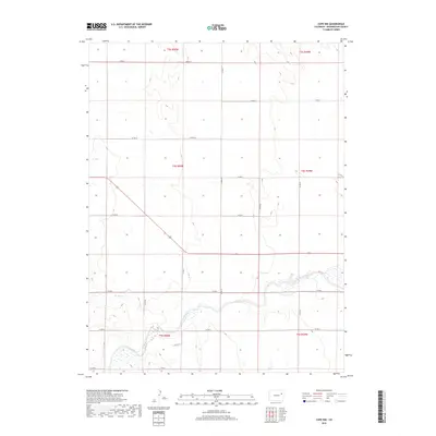
2019 Map of Cope NW
USGS Topo · Published 2019About this map
The Arikaree River meanders through the southern portion of this Washington County landscape, defining the primary drainage for this high plains region. Along its banks, the terrain is marked by wetlands and intermittent tributaries, including Gordon Cr, which flows into the river system from the west. The map reflects a meticulously planned grid of rural infrastructure, where local routes like Co RD 12 and Co RD 6 provide the primary access through the sections of townships t3s r50w and t4s r49w. This layout highlights the enduring legacy of the Public Land Survey System in eastern Colorado, showing how transportation and land use are dictated by the underlying township and range framework. The sparse distribution of named features underscores the open, agricultural character of the region during this 2019 survey.
Find a feature on this map
17 named features on this map. Tap any name to fly to it.
Don’t see what you’re looking for? This feature index may not catch every label — zoom into the map to look around manually.
Map Details
Editions of this 2019 Cope NW Map
This is the sole edition of this map. No revisions or reprints were ever made.
Other maps of this area

1954 · Limon
USGS Topo · 1:250,000

1957 · Limon
USGS Topo · 1:250,000

1958 · Limon
USGS Topo · 1:250,000

1974 · De Nova SE
USGS Topo · 1:24,000

1977 · Cope
USGS Topo · 1:24,000

1977 · Cope SE
USGS Topo · 1:24,000

1977 · Arickaree
USGS Topo · 1:24,000

1977 · Elba SE
USGS Topo · 1:24,000

1977 · Anton SE
USGS Topo · 1:24,000

1977 · Cope SW
USGS Topo · 1:24,000