
1974 Map of De Nova SE
USGS Topo · Published 1977About this map
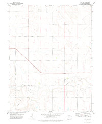
The boundary between Washington Co and Yuma Co defines the central axis of this High Plains landscape as it appeared in the mid-1970s. This region is characterized by its sparse settlement and reliance on groundwater, as evidenced by the numerous instances of Well locations distributed across the terrain. The presence of Donald Ranch provides a specific point of reference for local family history and the agricultural heritage of the Colorado plains. Apart from these ranching features, the inclusion of a Drill Hole suggests the ongoing exploration of natural resources beneath the surface during this period. The map's layout of section lines and fence lines illustrates the systematic division of the land, reflecting the enduring legacy of the Homestead Act and the spatial organization of eastern Colorado ranching country.
Find a feature on this map
4 named features on this map. Tap any name to fly to it.
Don’t see what you’re looking for? This feature index may not catch every label — zoom into the map to look around manually.
Map Details
Editions of this 1974 De Nova SE Map
This is the sole edition of this map. No revisions or reprints were ever made.
Other maps of this area

1954 · Limon
USGS Topo · 1:250,000

1957 · Limon
USGS Topo · 1:250,000

1958 · Limon
USGS Topo · 1:250,000

1968 · Joes
USGS Topo · 1:24,000
1974 · Abarr
USGS Topo · 1:24,000
1974 · De Nova NE
USGS Topo · 1:24,000
1974 · Beverly Grove
USGS Topo · 1:24,000
1974 · De Nova NW
USGS Topo · 1:24,000

1977 · Cope
USGS Topo · 1:24,000
1978 · Cope NW
USGS Topo · 1:24,000