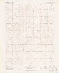
1974 Map of De Nova NE
USGS Topo · Published 1977About this map
The High Plains landscape of eastern Colorado is captured here along the dividing line of Washington Co and Yuma Co. The terrain is defined by a rhythmic pattern of undulating dunes and shallow basins, where land use in the mid-1970s was primarily dedicated to ranching and resource extraction. The small settlement of Seedorf appears as a focal point in the northeast, while the Price Ranch indicates the scattered nature of habitation in this arid region. Economic activity is represented by infrastructure such as a Storage Bin and a Gravel Pit, alongside several water wells and an Oil Well that reflect the area's reliance on both groundwater and mineral rights. This survey provides a precise look at the localized fence lines and unimproved roads that connected these remote outposts before modern expansion.
Find a feature on this map
7 named features on this map. Tap any name to fly to it.
Don’t see what you’re looking for? This feature index may not catch every label — zoom into the map to look around manually.
Map Details
Editions of this 1974 De Nova NE Map
3 editions found
Other maps of this area

1954 · Limon
USGS Topo · 1:250,000

1954 · Sterling
USGS Topo · 1:250,000

1957 · Limon
USGS Topo · 1:250,000

1958 · Limon
USGS Topo · 1:250,000

1958 · Sterling
USGS Topo · 1:250,000

1972 · Snyder Lake
USGS Topo · 1:24,000

1972 · Otis SE
USGS Topo · 1:24,000

1972 · Yuma South
USGS Topo · 1:24,000

1974 · De Nova SE
USGS Topo · 1:24,000
1974 · Abarr
USGS Topo · 1:24,000