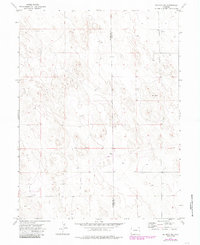
1974 Map of De Nova NE
USGS Topo · Published 1985About this map
The High Plains of eastern Colorado appear as a sparse network of ranching and utility infrastructure in this mid-1970s survey. Divided by the north-south boundary between Washington Co and Yuma Co, the landscape is defined by the subtle topography of sand hills and isolated water sources. Settlement is exceptionally light, anchored by the named locations of Seedorf and the Price Ranch.
Find a feature on this map
8 named features on this map. Tap any name to fly to it.
Don’t see what you’re looking for? This feature index may not catch every label — zoom into the map to look around manually.
Map Details
Editions of this 1974 De Nova NE Map
3 editions found
Other maps of this area

1954 · Limon
USGS Topo · 1:250,000

1954 · Sterling
USGS Topo · 1:250,000

1957 · Limon
USGS Topo · 1:250,000

1958 · Limon
USGS Topo · 1:250,000

1958 · Sterling
USGS Topo · 1:250,000

1972 · Snyder Lake
USGS Topo · 1:24,000

1972 · Otis SE
USGS Topo · 1:24,000

1972 · Yuma South
USGS Topo · 1:24,000

1974 · De Nova SE
USGS Topo · 1:24,000
1974 · Abarr
USGS Topo · 1:24,000