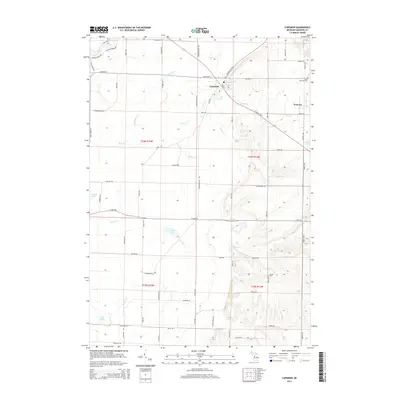
2014 Map of Copemish
USGS Topo · Published 2014About this map
The village of Copemish sits at the intersection of W Cleon St and Cadillac Hwy, serving as a central point in this rural landscape of northern Michigan. To the east, the smaller settlement of Pomona is located along Marilla Rd, while local heritage is preserved at the Cleon Township Cem and Marilla Cem. The terrain is defined by a dense network of seasonal and perennial waterways including Bear Cr, Dutchman Cr, and the series of numbered streams—First Cr, Second Cr, and Third Cr—that drain toward the Betsie River in the northwest.
Find a feature on this map
71 named features on this map. Tap any name to fly to it.
Don’t see what you’re looking for? This feature index may not catch every label — zoom into the map to look around manually.
Map Details
Editions of this 2014 Copemish Map
This is the sole edition of this map. No revisions or reprints were ever made.
Other maps of this area

1954 · Traverse City
USGS Topo · 1:250,000

1954 · Manitowoc
USGS Topo · 1:250,000

1956 · Onekama
USGS Topo · 1:62,500

1956 · Thompsonville
USGS Topo · 1:62,500

1956 · Frankfort
USGS Topo · 1:62,500

1957 · Copemish
USGS Topo · 1:62,500

1958 · Traverse City
USGS Topo · 1:250,000

1958 · Manitowoc
USGS Topo · 1:250,000

1976 · Frankfort SE
USGS Topo · 1:24,000

1976 · Onekama SE
USGS Topo · 1:24,000