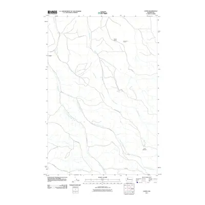
2011 Map of Coppei
USGS Topo · Published 2011About this map
Coppei serves as a central point in this part of Walla Walla County, where the landscape is defined by the diverging drainage of Coppei Creek and its major tributaries. The terrain rises significantly toward the east, reaching a high point at Jasper Mountain. Historically, this area is structured around the creek valleys, with rural roads often following the water courses. Bundy Hollow in the northeast is home to the Bundy Hollow Cemetery, a significant landmark for those tracing local family histories.
Find a feature on this map
24 named features on this map. Tap any name to fly to it.
Don’t see what you’re looking for? This feature index may not catch every label — zoom into the map to look around manually.
Map Details
Editions of this 2011 Coppei Map
This is the sole edition of this map. No revisions or reprints were ever made.
Other maps of this area

1919 · Walla Walla
USGS Topo · 1:125,000

1921 · Walla Walla
USGS Topo · 1:125,000

1937 · Pomeroy
USGS Topo · 1:96,000

1942 · Pomeroy
USGS Topo · 1:125,000

1953 · Walla Walla
USGS Topo · 1:250,000

1955 · Pullman
USGS Topo · 1:250,000

1958 · Pullman
USGS Topo · 1:250,000

1958 · Walla Walla
USGS Topo · 1:250,000

1966 · Dixie
USGS Topo · 1:24,000
1966 · Buroker
USGS Topo · 1:24,000